Posts Tagged ‘World Bank’

ReliEnvironmental and Social Impact Assessment (ESIA) is a process carried before any infrastructure development to ascertain the real impact and benefits of the project on the social, environment and what will be the mitigations to be undertaken to reduce negative biodiversity impacts. One of the key successes of any ESIA is by ensuring all stakeholders associated with the project are involved so that nobody is left out. These projects may be associated with housing, roads, dams, buildings and roads among others.

Kenya is increasingly experiencing implementation of major projects many being funded by big multilateral agencies such as European Union, AfDB and World Bank for electrification, geothermal and road constructions. One of the major requirements apart from project proposal is the institution of Environmental and Social Impact Assessment (ESIA) for any project together with Social and Environmental Management Plan (SEMP). But how many people take intense look at both ESIA and especially SEMP report and monitor if the recommendations stated in these documents are being carried out?

The assumption is that the mitigation of negative impacts as stated in the recommendations will be adhered to by the engineers, government agencies, and community or project affecting persons who all have a major role in ensuring the project is implemented according to the original plans.

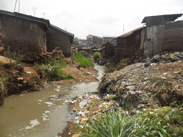
At what stage do we have ESIA National Environmental Management Authority making follow up after any projects ends and can the ESIA and SEMP reports still be used beyond the project timeline? Once the project starts, it is expected that the contractor will provide environmental management plan and possibly share it with the community and relevant authorities. Walking across major roads in Nairobi, it is common to notice open man holes and unfinished projects with no contractor on side which continuously poses a great danger to motorists and pedestrians. Look at Juja Road, Nairobi where a contractor left the site more than 10 years ago and unfinished open drainages, regular cabling projects and lack of pedestrians walking paths.

Lesson for Outering Road: On 31st May 2015, Citizen TV 9.00 pm news, aired item from of members of the public complaining about dangers posed by the open drainages and comments from victims along Thika Superhighway apart from regular road accidents. This clearly shows that once the project is finished then ESIA and SEMP becomes a forgotten document. Regular negative news from the much praised Thika Superhighway is not encouraging. The number of road accident especially by the pedestrian is quite high despite construction of footbridges together will less efforts to clear open air traders who have encroached on the pedestrian and bicycle paths is not encouraging.
The only visible ‘SEMP visible along Thika Superhighway is regular road maintenance most of it partly attributed by frequent road accidents. As the government and AfDB embarks on upgrading of Outering Road, it will be important for stakeholders to be informed and engaged in ensuring that Social and Environmental Management Plan is fully respected and monitored for a successfully projects.

Outering 2When Outering Road is fully upgraded into a dual there will be need to improve road in estates such as Kariobangi South, Umoja Donholm and Buru Buru plus areas such Mathare North and Kariobanging Light Industries. These estates have very few road entering Outering Road which might lead to frequent traffic jams at the junctions into the estates. Here are some of the junctions into the estates:

Roads Outering Rd

DSCF5237Finally the much awaited Outering Road construction was officially launched by President Uhuru Kenya on 22/1/2015. The new road will have new features such high speed and service lanes, walking and bicycle paths, bridges and flyovers. With these new development, it is expected that road users will be forced to up their skills how they interact with the road especially, public transport vehicles, pedestrians and motorists.

Public transport will have to content with ‘small’ space allocated as bus stop for busy routes such as Kayole, Umoja and Juja Road which have several bus / matatu numbers. Self discipline and obeying road signs will help reduce an unnecessary traffic jam and accidents.

Despite the road being busy and located in densely populated areas it does not have a single foot bridge. Pedestrians will enjoy the services of more than 10 footbridges along the 13Km road and side walks. Currently, some pedestrians have been knocked while attempting to cross the road. Experience from Thika Super Highway has shown that there is need to create awareness on road safety which the road is being constructed plus ensuring community participate identifying appropriate location for bridges based on access to resources as such as markets, learning institutions, bus stops and residential areas.

Outering Road will have high speed lanes which will see easier movement of people and goods. This will call for road design that will deter pedestrians from crossing at undesignated areas.

Cyclists will enjoy the new cycling lanes which were not there before. The Kenya Urban Roads Authority and Nairobi County government should ensure that walking and cycling paths are protected so as not to be invaded by hawkers and other open air traders as in the case of Thika Super High Way at Githurai and GSU fly over.

All road users will have to develop new skills once the new look Outering Road is completed. Given that this will be most high speed road, use of CCTV cameras will come in handy in nabbing traffic offenders while associated agencies can carry our massive awareness on road safety before the completion of the project. – Simon

Houses constructed next to the river

Houses constructed next to the river


It is now becoming a common feature in the newspaper to read an individual or a group of people also known as Project Affected Persons (PAPs) raising concerns how infrastructure development projects are being implemented in their locality. From Kitui, Kajiado to Turkana local people have raised issues about these projects in their areas. To some bureaucrats, financiers, investors and contractors PAPs are unreasonable, narrow minded, short sighted and as described by Nation newspaper columnist recently ‘a group with over exaggerated sense of rights’. Why do PAPs emerge with grievances in the middle of the project implementation and how best can their issues be addressed?

People are now more informed than before when community rarely asked questions but instead clapped for any kind of development coming their way. The cases that have been highlighted in the media, has exhibited limited lack of involvement, engagement, participation and consultation by between the state agencies concerned and the people.
Currently people in Kajiado are not happy and are seeking same treatment as other areas when it comes to compensation for way leaves (power lines) to pass through their area. Consulting the locals and even undertaking an exchange program would have helped reduce misunderstanding between the organs concerned. The Standard Gauge Railway project is also bound to encounter similar challenges since most of its land have either been grabbed or encroached after many years of being partially in operation. The conditions set by the financiers of the project are not known to the PAPs. The institutional frame work should as much as possible work to address emerging concerns during the appraisal stages.

Kenya’s geo strategic locations and recent discovery of oil and other minerals has and will ‘force’ the government to rethink how best to strengthen its position in the region by investing in infrastructure and to improve the living standards of its citizens so as to attract more investment. Any good citizen will support the state when it comes to development but the government should protects it people against exploitation of any form.

There has been a lot of encroachment on land set aside for development in different parts of our country and this calls for proper engagement mechanisms to developed from appraisal to implementation stages. If today we are to implement rehabilitation of Nairobi River Project be sure that from Kibera to Mathare that there will be thousands of people to be relocated.
An extensive public consultation for PAPs can be an expensive affair but also very beneficial for the success of any project. Social development specialists must play a critical role in highlighting community concerns during Environmental and Social Impact Assessment since this will show a significant connection between the project being implemented and the community. Building schools, hospitals and boreholes goodies should go a step further by education and creating more awareness about the real benefits of the project being implement. As a society it will be naïve not to expect a person who is just about to be dislocated or whose property will be affected not to raise any concern.

traders 1The much awaited Nairobi Outering Road improvement project will start next month with traders operating along the road corridors expected to be relocated in the Nairobi County Markerts. This is according to Dr. Evans Kidero, the Nairobi City County Governor as reported in the Daily Nation of 17/9/2014.
The recently completed Eastleigh First Avenue which had traders operating along it busy road saw most of the small scale businesses disrupted to pave way for the upgrading of the road. The development of the road has greatly reduced traffic jam while it has also forced traders to seek alternatives elsewhere.
One thing that has come out during the upgrading of major roads in Nairobi is the ill preparedness of the Nairobi County to devise strategies of assisting small scale traders resettled before and during road construction. In Eastleigh, public lands have all been either grabbed or sold to private developers. The once famous Eastleigh Nairobi City County Market is no more.
The Nairobi City County government must develop strategies to help resettle small scale traders since this is a common feature along main Nairobi roads; From Mlango Kubwa to Outering Road about, City Stadium to Donholm Road About, at Kangemi , GSU roundabout and Githurai Thika Superhighway all have been invaded by small scale open air traders.
All the City County Markers along these major roads are full to capacity while the newly constructed stalls are controlled by private developers during allocations and are beyond the reach of ordinary open air traders which cost between Ksh. 150,000 to Ksh. 200,000 depending with where it is located.
Appraisal and Environment and Social Impacts reports give very little mention of small scale open air traders while it is also assumed that Nairobi City County will make prompt investment in relocating the traders to officially recognized spaces. In these reports permanent structure owners and landlords are at advantageous position to argue out for proper compensation than small scale open air traders.

FROM the back of St Mary’s Mission Hospital, two hours north of Nairobi, Kenya’s capital, convalescent patients can watch flamingos frolic on Lake Elementaita. From the front, the view is less idyllic. Overloaded lorries race along the A104, a busy part of the Northern Corridor, east Africa’s main trade route. Each month, says Robert Limo, a researcher at the hospital, at least two patients are readmitted, having been run over just minutes after being discharged while waiting for a bus.

This stretch of road was upgraded in 2008 with funding from the European Union. But almost all the $91m went on asphalt and almost none on safety, so the road that was supposed to make everyone richer has brought grief, too. Cars and lorries now speed by at 130kph (80mph). The road has no provision for overtaking or protection for pedestrians and casualties inundate local hospitals, with two or three a week coming to St Mary’s from a 5km stretch alone. The picture is repeated across Kenya as the country’s roads are upgraded with little thought for safety. Road casualties now account for half of admissions on its surgical wards.

Every 30 seconds someone, somewhere, dies in a road crash, and ten are seriously injured. The toll is rising: the World Health Organisation (WHO) expects the number of deaths globally to reach nearly 2m a year by 2030, up from 1.3m now. But the pain will fall far from equally. Rich countries are making roads safer and cutting casualties to rates not seen for decades, despite higher car use. Poor and middle-income ones will see crashes match HIV/AIDS as a cause of death by 2030 (see chart). In the very poorest, the WHO expects deaths almost to triple.

Where incomes are low, for example in Bangladesh and Kenya, pedestrians top the body count. As they rise, so does the use of motorbikes—often for the precarious transport of entire families. In Thailand motorcyclists are more than two-thirds of fatalities. A bit richer still, and four wheels dominate. In Argentina, Russia and Turkey the main victims are inside cars, buses and lorries.

Higher vehicle standards are a big reason for falling death rates in the rich world. But many other safety measures are simple and cheap. Roads used by pedestrians got pavements and crossings. Fast traffic was separated from cyclists and pedestrians. Governments advertised the need for seat belts and motorcycle helmets, and enforced speeding and drunk-driving laws.

Where safety has been put first, the results have been remarkable. Though a tragic run of crashes has killed three pedestrians and a cyclist in New York in recent days, speed bumps, pedestrian countdown lights and slow zones around schools mean that the city now has fewer deaths each year than when it started counting in 1910. Sweden has halved road deaths since 2000, and cut them by four-fifths since 1970.

But in the developing world, laws and safety measures are failing to keep up with population growth, urbanisation and rising car use. Development banks and donors often make matters worse, says Kavi Bhalla of the Johns Hopkins Centre for Global Health, by paying for new roads that are fast but not safe.

Over one in three road-accident victims are under 30: crashes are the leading cause of death for 15- to 29-year-olds worldwide. Most of the casualties are men and boys, who use roads more, and take more risks. That means that many were breadwinners, or could have expected soon to be.

So crashes take a huge financial toll as well as an emotional one. A dead or maimed 17-year-old costs much more in lost earnings than an 80-year-old. A victim’s family is often plunged into poverty for two or even three generations, says Avi Silverman of the FIA Foundation, a London-based road-safety charity. The International Road Assessment Programme (iRAP), an engineer-led road-safety charity, calculates that road deaths and injuries cost 2% of GDP for high-income countries and 5% of GDP for middle- and low-income countries, including medical bills, care, lost output and vehicle damage—$1.9 trillion a year globally.

Each year $500 billion is spent on new roads. By linking isolated communities to schools, hospitals, jobs and markets, they boost development. But just 1-3% of the construction budget is often enough to make a road much safer, says Rob McInerney of iRAP. And safer roads have much higher returns, says Veronica Raffo of the World Bank.

iRAP has helped to build fences to separate pedestrians from traffic in Bangladesh, at a cost of just $135 to avert a death or serious injury; and installed rumble strips on hard shoulders in Mexico to alert drivers when they are veering from their lane ($920). Telling people about safety laws—and then making those laws stick—can be surprisingly affordable and effective, too. The share of people wearing seat belts in Ivanovo, Russia, rose from 48% in 2011 to 74% in 2012, after a police crackdown and social-media campaign partly paid for by Bloomberg Philanthropies, the foundation of Michael Bloomberg, New York’s former mayor and one of the few big aid donors to spend heavily on road safety. Dan Chisholm of the WHO calculates that enforcing speed limits and drunk-driving laws in South-East Asia would cost just 18 cents per person per year.

In the Nesco school in Kibera, Kenya’s largest slum, the children recently received government-funded vaccinations for measles and polio. And aid donors have pledged $600m to fight HIV/AIDS, tuberculosis and malaria in the country in the next few years, and $4 billion globally. But with multi-lane highways to navigate on the way to school, and a lack of safe crossings, a quarter of the pupils have been in a road crash and a third have seen a close relative injured or killed. A little more spent on road safety would help more children in Kibera, and across the developing world, make it safely into adulthood. Copied from: (http://www.economist.com/news/international/21595031-rich-countries-have-cut-deaths-and-injuries-caused-crashes-toll-growing)

Railway Crossing at Buru Buru

One major component of highway upgrading involves greening the road due to emission and other environmental factors related to the new development. During road construction, the landscape changes and in some cases trees have to be uprooted to give way. During or after the new road is completed efforts are put to ensure that along the highway we have some vegetation. The focus is usually done while no major efforts are invested in greening communities near the road.

Very little efforts are employed to ensure that neighbouring communities are also greened. Outering Rd neighbour communities with less vegetation like, Kariobangi, Umoja, Mathare and Mathare North. The contractor and government agencies concerned should also invest in tree planting in this neighbourhood given that they carry high population and they will be affected by the high numbers of cars that are expected to use the road.
Space is an issue in these place but more trees could be planted in schools, raparian lands and religious institution to help improve air quality in these densely populated communities.

____________________________________________________________________________________________

Obstacles to Implementing Green Highways (http://www.astm.org/SNEWS/SO_2008/bryce_so08.html)

Before any new technology can be introduced in society, it must be verified by a consistent history and accepted as safe for use. Most techniques that will lead to the creation and implementation of a green highway system are very young. Standards and research will aid in the development of a track record for technologies, but implementation of technology requires performance assurance.

DSCF5194
There has been so many ongoing projects along roadside like laying of cables along Juja Rd. This is a trend that is most likely to continue with advancement in technology.
Below is a check list from http://www.kenha.co.ke/index.php?option=com_jdownloads&Itemid=148&view=viewdownload&catid=15&cid=20

Checklist/Requirements for Roadside Developments
1. Application to construct or improve access roads to Class A, B, or C roads
• Application letter detailing the proposed developments and justification.
• A survey of the property from the Survey of Kenya
• Detailed Engineering Design Drawings with general layout, cross-sections and all other relevant details to scale (2 copies).
• A geo-referenced map (UTM map projection, Arc 1960 Datum) giving location and affected plot(s) in relation to the road (2 printouts and soft copy (CAD)).
• Complete application copied to Regional Manager of respective region for comments/consent following a site visit. Alternatively a site visit report from an officer from HQ.

2. Application to lay communication cables along and/or across class A, B or C roads
• Application letter detailing the proposed developments and justification.
• Detailed Engineering Design LayoutDrawings overlain on a properly geo-referenced map (UTM map projection, Arc 1960 Datum)showing cadastral data, longitudinal profile, cross-sections of typical trenches and road crossings (micro-tunneling), junctions and manholes/handholes with coordinates and all other relevant details to scale.Coordinates (X, Y) list for all the utility line bends and manholes/handholes should also be included in the map. Layout drawings should be provided for a scale of 1:2500 for the general layout and 1:500 for the details (crossings) and provided in 2 printed copies and in soft (CAD).
• Where service ducts are provided, the applicant shall not be allowed to lay the cable at any other point.
• Copied to Regional Manager of respective region for comments/consent following a site visit. Alternatively a site visit report from an officer from HQ.

3. Application to lay water pipelines along and/or across class A, B or C roads
• Application letter detailing the proposed developments and justification.
• Detailed Engineering Design Drawings overlain on properly geo-referenced maps (UTM map projection, Arc 1960 Datum)showing pipeline network and pipeline size(s), layout and profiles in relation to road, cross-sections of typical trenches and road crossings(reinstatement details where applicable), details of river crossings, road over rail/river bridge crossings & anchorages and all other relevant details to scale. Coordinates (X, Y) list for all the utility line bends and manholes should also be included in the map. Layout drawings should be provided for a scale of 1:2500 for the general layout and 1:500 for the details (2 printed copied & soft copy(CAD)).
• Where appropriate service ducts are provided, the applicant shall not be allowed to lay the pipe at any other point.
• Copied to Regional Manager of respective region for comments/consent following a site visit. Alternatively a site visit report from an officer from HQ.

4. Application to lay sewer lines along and/or across class A, B or C roads
• Application letter detailing the proposed developments and justification.
• Detailed Engineering Design Drawings overlain on properly geo-referenced maps (UTM map projection, Arc 1960 Datum) showing pipeline network and size(s), layout and profiles in relation to road, cross-sections of typical trenches and road crossings(reinstatement details where applicable) and all other relevant details to scale. Coordinates (X, Y) list for all the utility line bends and manholes should also be included in the map. Layout drawings should be provided for a scale of 1:2500 for the general layout and 1:500 for the details (2 printed copied & soft copy (CAD)).
• Copied to Regional Manager of respective region for comments/consent following a site visit. Alternatively a site visit report from an officer from HQ.

5. Application to erect power lines along and/or across class A, B or C roads and,
• Application letter detailing the proposed developments and justification.
• For underground cables, Detailed Engineering Design Drawings overlain on properly geo-referenced maps(UTM map projection, Arc 1960 Datum) detailing cable size(s), layout in relation to road, cross-sections of typical trenches and road crossings(micro-tunneling), road over rail/river bridge crossings & anchorages and all other relevant details to scale. Coordinates (X, Y) list for all the utility line bends and manholes should also be included in the map. Layout drawings should be provided for a scale of 1:2500 for the general layout and 1:500 for the details (2 printed copied & soft copy(CAD)).
• For overhead cables, detailed Engineering Design layout drawing showing the cable route and the position of all poles overlain on a properly geo-referenced map.
• Copied to Regional Manager of respective region for comments/consent following a site visit. Alternatively a site visit report from an officer from HQ.

6. Application to install any form of advertisement on road reserves along class A, B or C roads
• Application letter detailing the proposed developments and justification.
• A properly geo-referenced location map (UTM map projection, Arc 1960 Datum) showing all salient features and the location of the advertisement structure (with coordinates) in relation to the road and other existing utilities. Maps should be provided for a scale of 1:2500 for the general layout and 1:500 for the details (2 printed copied & soft copies(CAD)).
• For the support structure, detailed Engineering Design Drawing and supporting computations certified by a Registered Structural Engineer (2 copies).
• Copied to Regional Manager of respective region for comments/consent following a site visit. Alternatively a site visit report from an officer from HQ.

src=”https://outeringroad.wordpress.com/wp-content/uploads/2014/03/ted2014_dd_dsc_5123_1920.jpg?w=300″ alt=”Featured Image — 225″ width=”300″ height=”199″ class=”aligncenter size-medium wp-image-226″ />

road signsGood road should be there to enhance public safety for all road users such as motorists, pedestrians and animal crossing. Road signs play a great role in promoting safety and proving cautionary measures.
Thika Super Highway has seen new features such bridges, drainage reduction in hill elevation for some section. One common feature along Thika Super Highway is people crossing in none designated sections. Near Roysambu roundabout next power station people are seen attempting to cross and ignoring the bridge which is next to the bus stage. There are no road signs warning pedestrians not to cross the road.
Our government should promote education on road signs regularly for all road users. For example the bicycle tracks along Thika Super Highway have either been invaded by motorbikes or hawkers thus discouraging bicycle users especially section next to Alsops or opposite GSU. Hawkers operating near the highway should also be involved in road sign education programme since they are always interacting with many people each day.
Outering Road has an opportunity to integrate more use of road signs from the start instead introducing them after the road is finished. I came across this handbook from United Kingdom, is a handbook which indicates all road signs likely to be found while driving in UK. (www.direct.gov.uk/prod_consum_dg/groups/dg…/dg_191955.pdf‎)

DSCF5194John Kamau has been operating a small Kiosk along Outering Road for the last ten years. When he saw a Chinese worker supervision digging of drainage along next Mathare River that is when he realized that government was serious about Outering Rd Upgrade project.
Together with some friends who has seen this blog, they came looking and I shared the proposed design of the road and how his business will be affected. I also shared various reports from KURA and African Development Bank.
Looking at these report, small scale traders were surprised that they had not been consulted or involved. Now they are wondering what will happen to their source of livelihood.
Small scale traders have now ganged up and written a petition to KURA and African Development Bank. I will be given a copy of their signed petition which I promised to share on this blog.